Wednesday, January 5th 2022, 10:55 am – Winter warnings span B.C. for the next potent system that threatens up to 30 cm of snow over parts of the South Coast.
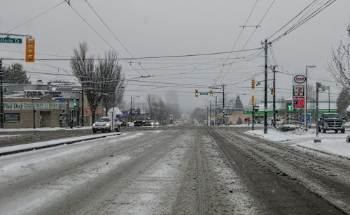
Arctic air has been aimed squarely at Western Canada in recent weeks, bringing about frigid temperatures across B.C. and the Prairies. With the cold air pressing onto the B.C. coast, precipitation has been falling as snow in the lower elevations with recent systems, rather than the usual rainfall, because of low temperatures. With that, a secondary snowy system this week is ready to take aim at the South Coast once again. A high-impact winter storm will trek through Wednesday evening, bringing substantial snow totals to the higher terrain and all the way down to sea level along the coast. This is likely to have considerable impact on travel, especially during rush hour commutes. More on the timing and impacts of the inbound winter storm and when to finally expect milder temperatures, below.
WEDNESDAY INTO THURSDAY: MORE HEAVY SNOW PROMPTS WIDESPREAD WARNINGS
The next incoming system will be a high-impact winter storm for the South Coast of B.C. Wednesday evening and continuing into Thursday. Heavy snow will fall, possibly changing to ice before ending as rain for coastal areas. A wide range in snow totals is likely, but substantial accumulations are expected down to sea level along the coast.
The Lower Mainland, including Metro Vancouver, the Fraser Valley and the Sunshine Coast could see 15-30 cm of snow through Thursday. Significant accumulations are anticipated for the southern Interior, as well. Accumulative totals for some of the mountain passes could reach 50 cm.

There may be a significant impact on rush-hour traffic in urban areas as a result.
“Consider postponing non-essential travel until conditions improve. Rapidly accumulating snow could make travel difficult over some locations. Surfaces such as highways, roads, walkways and parking lots will become icy, slippery and hazardous,” Environment and Climate Change Canada (ECCC) says in the winter storm warning that’s in effect for the region.

Snow at times heavy will persist into late Thursday morning before easing off to flurries in the afternoon.
Given the fresh snowfall on the ground and what’s to come, there’s a considerable risk for avalanches for the coastal mountains around the Sea-to-Sky region Wednesday, according to Avalanche Canada.
Beyond the impacts of the next storm, the frigid pattern finally breaks down this weekend with much milder weather expected for next week. Conditions will remain unsettled at times through next week, but no major storms are expected and coastal areas won’t see any snow for the next couple of weeks.
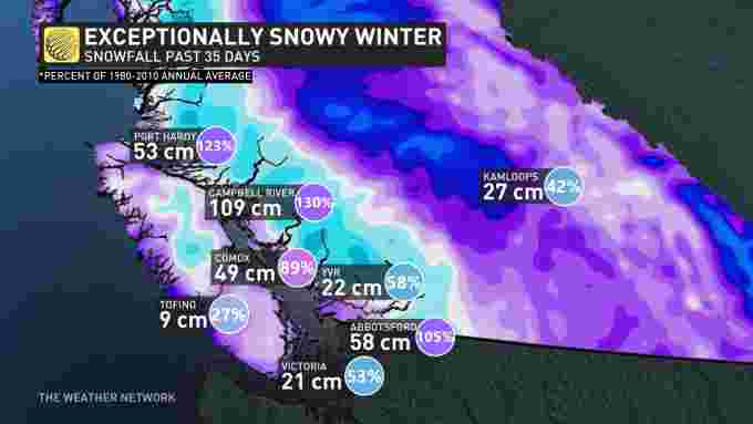
SOME CITIES HAVE ALREADY RECEIVED MORE THAN THEIR YEARLY SNOWFALL AVERAGE
According to The Weather Network meteorologist Tyler Hamilton, Campbell River has already recorded 130 per cent of its typical annual snowfall (1980-2010) in just 29 days, “with more on the way.”

Port Hardy and Abbotsford, meanwhile, have already picked up 123 and 105 per cent of their annual snowfall average, respectively.


